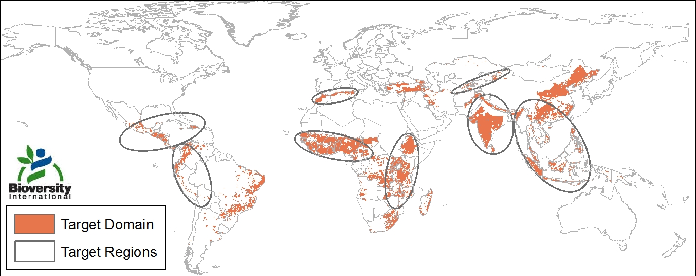
2011 | Calculating rain-fed and poor agricultural areas
The objective of this project was to geographically identify the target domain of research for Bioversity International in the coming decade. To achieve this objective, the relevant geographic information was identified as GIS base maps that were freely available on the internet. On these maps the farming systems that were smallholder and rain-fed were selected. The areas also had to be significantly poor and should have recent research exposure. To calculate the areas GIS geoprocessing tools were used (e.g. intersect, buffer, union). The project resulted in the identification of eight regions, two in South America and three in both Africa and in Asia. The combined poor target population (daily income <2USD) was about 830 million. Finally the physical properties, land-use and suitability for agriculture of the areas were described using GIS overlaying techniques. The results were published as an internal report.
